


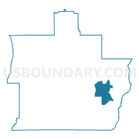
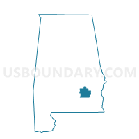
M Pillar Church, Pike County, Alabama
About
Outline

Summary
| Unique Area Identifier | 522808 |
| Name | M Pillar Church |
| County | Pike County |
| State | Alabama |
| Area (square miles) | 17.10 |
| Land Area (square miles) | 17.10 |
| Water Area (square miles) | 0.00 |
| % of Land Area | 99.97 |
| % of Water Area | 0.03 |
| Latitude of the Internal Point | 31.76136600 |
| Longtitude of the Internal Point | -85.78841580 |
Maps

Graphs
Select a template below for downloading or customizing gragh for M Pillar Church, Pike County, Alabama


Neighbors
Neighoring Voting District (by Name) Neighboring Voting District on the Map
- Banks City Hall, Pike County, AL
- Brundidge-Haisten Building, Pike County, AL
- Galloway Road Community Center, Pike County, AL